


Land
Last Updated
Overview
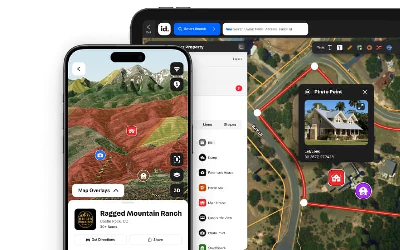
Land id helps professionals research properties, access nationwide parcel data, and create interactive, shareable maps. It includes property boundaries, map overlays, comparable sales reports, and branded map sharing tools. While advanced GIS-level analysis may be limited, it is well-suited for real estate professionals, ranchers, farmers, appraisers, and land-focused teams.
Land Specifications
- Reporting And Analytics Dashboards
- Mobile Accessibility
- Space Management And Planning
- Asset Lifecycle Management
What Is Land id?
Land id is a property-mapping software designed for real estate professionals, ranchers, farmers, appraisers, builders, landowners, and others interested in land research. Land id offers nationwide private and public parcel data, property boundaries, and over 40 map overlays accessible on desktop and mobile devices. Users can create, share, and embed interactive maps, generate comparable sales reports, and access high-resolution imagery and data tools to research and present land information clearly.
Land id Pricing
The Land id cost is structured around the following plans:
Land id
- Land id - $15/month/user/month
- Land id Premium - $20/month/user/month
Land id Pro
- Three - $49.99/month/user/month
- Unlimited - $79.99/month/user/month
Disclaimer: The pricing is subject to change.
Land id Integrations
Who Is Land id For?
The platform caters to a variety of industries, including:
- Real estate
- Agriculture
- Appraisers
- Engineering
- Forestry
- Government
Is Land id Right For You?
If you’re a real estate professional, rancher, farmer, appraiser, builder, landowner, or simply curious about land, Land id provides access to nationwide parcel data and interactive property mapping tools on desktop and mobile. It is designed to help users research properties, create maps, and showcase land information in a dynamic format.
Trusted by over 40,000 industry professionals, including USDA, JLL, and Sotheby’s International Realty, Land id may be a strong fit for those who need extensive property data and customizable map creation in one platform.
Still not sure if Land id is right for you? Our support staff is available at (661) 384-7070 to help you make the right choice.
Land Features
Parcel Data
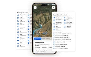
Land id provides extensive nationwide private and public parcel data with detailed property lines, ownership records, zoning, and assessment information. It enables parcel searches by APN or owner name, waypoint-based land insights, and CSV mailing list exports for outreach and analysis.
Smart Search
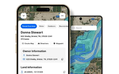
Land id delivers a fast, flexible Smart Search tool that retrieves parcel results using addresses, APNs, owner names, or coordinates across web and mobile. It displays detailed owner, assessment, and building information, along with GPS directions, for streamlined property discovery.
Map Creation
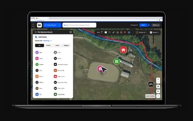
The platform enables custom map creation for property visualization, boundary drawing, contextual labeling, and spatial measurement across desktop and mobile environments. It supports managing, sharing, and presenting land data with interactive tools for clearer geographic understanding and analysis.
High-Res Aerial Basemap
The software offers high-resolution aerial basemaps built from frequently refreshed imagery for detailed property visualization and analysis. It delivers enhanced zoom capabilities and updated satellite views to assess landscape changes, construction progress, and on-site conditions remotely.
Basemap And Overlays
Land id features more than 40 interactive map overlays nationwide, including infrastructure, water, soil, and property layers for contextual land analysis. It allows layered visualization of real-time data to support informed planning, evaluation, and geographic decision-making.
Pros And Cons of Land
Pros
Clean, intuitive, and user-friendly interface
Strong map customization and styling options
Powerful mobile access for maps on-the-go
Cons
Lacks advanced GIS-level capabilities
Some parcel data is difficult to access
Land Reviews
Total 13 reviews
4.5
All reviews are from verified customers
Rating Distribution
5
Stars54%
4
Stars38%
3
Stars8%
2
Stars0%
1
Stars0%
Share your experience
Small Business, 11-50 employees
“Detailed maps that help”
Pros
MapRight has been a really effective tool for building maps that are both detailed and visually appealing. I especially enjoy being able to add icons, labels and even create 360-degree views without much hassle. That extra layer of customization adds a lot of flair to my presentations and when I combine it with data, it helps me tell a much more compelling story.
Cons
One downside is that the mobile version of MapRight feels quite limited compared with the desktop application. Some features, like adjusting more complex data parameters or creating customized reports, just aren't available on mobile. That becomes frustrating when I'm traveling and only want to make a few quick edits away from my computer.
Rating Distribution
Ease of use
9
Value for money
9
Customer Support
9
Functionality
8
Mid Market, 500+ employees
“Mapping works anywhere”
Pros
Sharing and reading maps with MapRight is very easy whether I'm embedding them on a website sending them by email or exporting them as a PDF for printing. The mobile app adds a lot of flexibility because it lets me carry my maps wherever I go. There are plenty of styling and customization tools available too including drawing boundaries labeling and grouping specific items and tracking important information visually. It brings GIS capabilities within reach by keeping the features user-friendly and accessible.
Cons
MapRight does a very superb job when it comes to property communication but it would be even better with more advanced functionality. Real-time reporting is another feature that still feels missing and would add a lot of value.
Rating Distribution
Ease of use
10
Value for money
10
Customer Support
10
Functionality
9
Construction, 11-50 employees
“easy to use for GIS analysts”
Pros
The way it's set up is super approachable and the built-in features really pulled me in as a GIS analyst. I'm able to work with it without constantly second-guessing how things should work which makes my workflow feel much more efficient.
Cons
The UI looks quite attractive already but it could use a small tweak or two to make things even better.
Rating Distribution
Ease of use
10
Value for money
10
Customer Support
10
Functionality
10
Frequently Asked Questions
Does Land id offer an API?
No, Land id does not offer an API.
Who are the typical users of Land id software?
Land id supports multiple industries, including real estate, agriculture, appraisal services, engineering, forestry, and government sectors.
What language does Land id support?
Land id primarily supports the English language.
Does Land id have a mobile app?
Yes, Land id offers a dedicated mobile application for iOS and Android devices.
What other apps does Land id integrate with?
Information about third-party integrations has not been specified by the vendor.
What types of pricing plans does Land id offer?
Pricing for Land id includes a variety of plans, including Land id at $15/user/month, Land id Premium at $20/user/month, and Land id Pro plans at $49.99/user/month (Three) and $79.99/user/month (Unlimited), with a free trial available. Request a detailed Land id price breakdown for your organization today.
What level of support does Land id offer?
Land id offers support through FAQs, videos, chat, tutorials, a help center, an online contact form, and phone.