
Last Updated
Overview
SkyWatch is a leading geospatial data platform that simplifies access to satellite imagery for organizations of all sizes. It offers transparent, pay-as-you-use pricing and strong compliance standards. While some users report slower customer support response times, its intuitive interface and scalable solutions make it a solid choice across industries.
Be the first one to leave a review!
No review found
Starting Price
Custom

SkyWatch Specifications
- Compliance And Safety Management
- Reporting And Analytics Dashboards
- Vendor Contract Management
- Real Estate And Lease Management
What Is SkyWatch?
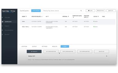
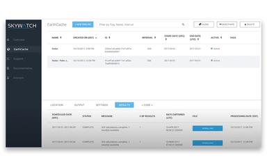
SkyWatch is a cloud-based geospatial data platform for developers, enterprises, and organizations needing satellite and aerial imagery. The software includes modules such as Explore, Hub, Map, Build, and Connect, each offering its own set of features and additional capabilities for geospatial data management. It enables users to centralize procurement, storage, and sharing of geospatial assets, while providing up-to-date imagery directly within GIS workflows for enhanced operational planning, risk management, and streamlined decision-making across projects.
How Much Does SkyWatch Cost?
SkyWatch pricing starts at $2.50/km² (minimum AOI: 5 sq. km) for Archive imagery, with High resolution (50 cm) at $10/km² (minimum 1 km²), Very high resolution (30 cm) at $22.50/km² (minimum 5 km²), and Very high resolution (15 cm) at $40/km² (minimum 5 km²).
It also offers a Tasking plan starting at $12/km² for High resolution (50 cm), $32.50/km² for Very high resolution (30 cm), and $60/km² for Very high resolution (15 cm), each with a minimum AOI as low as 25 sq. Km.
In addition to the SkyWatch subscription plans, additional costs may apply and can vary depending on satellite imagery usage, API requests, data volume, storage needs, and optional analytics or integration tools, generally aligning with industry-standard ranges for advanced geospatial platforms.
- Satellite imagery and data usage: $0.50–$30+ per sq km (or usage-based credits) - Costs vary depending on resolution, sensor type (optical vs. SAR), archive vs. tasking requests, and frequency of access
- Implementation and workflow setup: $1,000–$10,000 - Configuration of approval workflows, user permissions, GIS integrations, and internal data governance processes
- API and advanced integration access: $500–$5,000/year - Programmatic data access, custom application integrations, and automation within enterprise systems
- Enterprise compliance and support packages: $2,000–$15,000/year - Enhanced SLAs, security reviews, audit documentation, and priority technical support for regulated industries
Disclaimer: The pricing is subject to change.
SkyWatch Integrations
The software integrates with the following third-party applications, including:
- Nearmap
- Esri
- Eagleview
- Spexi
Who Is SkyWatch For?
SkyWatch software serves a wide range of industries, including:
- Geospatial technology
- Environmental monitoring
- Agriculture
- Urban planning
- Insurance
- Energy and utilities
- Infrastructure and construction
Is SkyWatch Right For You?
Are you looking for a scalable platform to unify satellite imagery access, procurement, and delivery across teams? SkyWatch helps organizations overcome the complexity of multi‑provider data sourcing and governance, simplifies data procurement workflows, and accelerates geospatial insights without heavy internal infrastructure investments.
SkyWatch’s privacy and data handling practices align with the General Data Protection Regulation (GDPR) requirements for users in the EU and other regions with robust privacy laws, ensuring lawful processing and the protection of user rights.
Trusted by leading providers including Planet, AWS, BlackSky, and EagleView, SkyWatch delivers reliable and high-quality geospatial data.
Built on secure infrastructure with industry‑standard safeguards and ongoing vulnerability disclosure processes, the platform supports scalability and secure growth for expanding geospatial use cases.
Still not sure if SkyWatch is right for you? Contact our customer support team at (661) 384‑7070, who will help you make the best decision regarding the overall SkyWatch Features.
SkyWatch Features
Hub
Hub provides enterprises with a centralized system to manage geospatial data operations, budgets, and governance. It helps organizations improve ROI, control procurement policies, normalize datasets, and securely distribute imagery across teams. Built-in tools for approvals, user management, metrics, and visualization streamline oversight and enhance data-driven decision-making.
Connect
Connect enables data providers to distribute geospatial content across the SkyWatch ecosystem and third-party applications. It provides secure user access, compliance enforcement, real-time order management, merchandising controls, predictive demand analytics, and detailed reporting, helping organizations maximize visibility, revenue, and operational insight for their geospatial assets.
Build
Build provides developers with a turnkey API solution to integrate geospatial data discovery, purchasing, and publishing into custom applications. It offers secure identity management, tasking, order fulfillment, payment processing, and location services, enabling seamless access to millions of km² of imagery while supporting revenue generation and efficient platform integration.
Explore
Explore enables users to discover and purchase archive or tasked imagery from over 700 sensors through a unified, intuitive interface. It streamlines geospatial data procurement with transparent pay-as-you-use pricing, precise AOI selection, downsampled previews, secure checkout, and simplified access to high-resolution Earth observation content.
Map
Map delivers seamless access to premium and up-to-date Earth observation data directly inside ArcGIS environments. It integrates with ArcGIS Online, Enterprise, and ArcGIS Pro through the Content Store and add-in, enabling users to stream high-quality satellite and geospatial content without leaving their GIS workflows.
Pros And Cons of SkyWatch
Pros
Centralizes enterprise data management and operational oversight
Simplifies access to high-resolution Earth observation imagery
Streamlines procurement across multiple geospatial data providers
Cons
Documentation gaps may hinder user workflows
Support gaps can slow down problem resolution
SkyWatch Reviews
No reviews yet!
Be the first to review this product
Frequently Asked Questions
Does SkyWatch offer an API?
Yes, SkyWatch provides API access.
Does SkyWatch have a mobile app?
No, SkyWatch does not have a mobile app.
What language does SkyWatch support?
SkyWatch supports the English language.
What other apps does SkyWatch integrate with?
The software integrates with the following third-party applications, including Nearmap, Esri, Eagleview, and Spexi.
Who are the typical users of SkyWatch?
SkyWatch software serves a wide range of industries, including geospatial technology, environmental monitoring, agriculture, urban planning, insurance, energy and utilities, and infrastructure and construction.
What types of pricing plans does SkyWatch offer?
SkyWatch pricing starts at $2.50/km² for Archive imagery (minimum AOI: 5 sq. km) and $12/km² for Tasking imagery (minimum AOI: 25 sq. km). Request a custom SkyWatch price quotation.
What level of support does SkyWatch offer?
SkyWatch provides support via contact form.